EN 

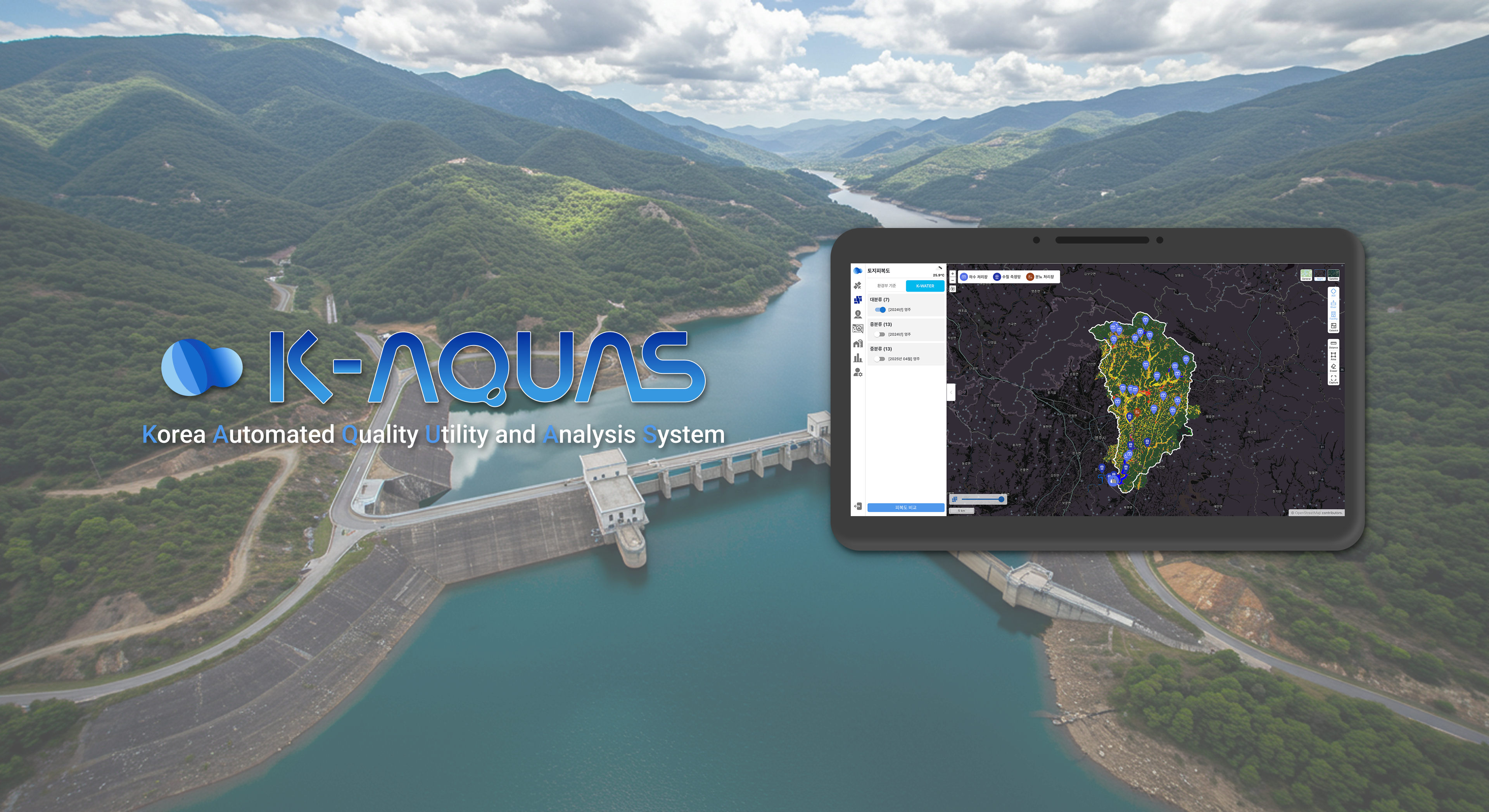
Combining satellite and drone data with artificial intelligence (AI)
Integrated Pollution Source Management and Monitoring System

Various pollutants are concentrated in upstream areas, and water quality deterioration
such as green algae, is repeatedly occurring.
However, it is difficult to respond in real time and select efficient management areas
using existing manual methods..
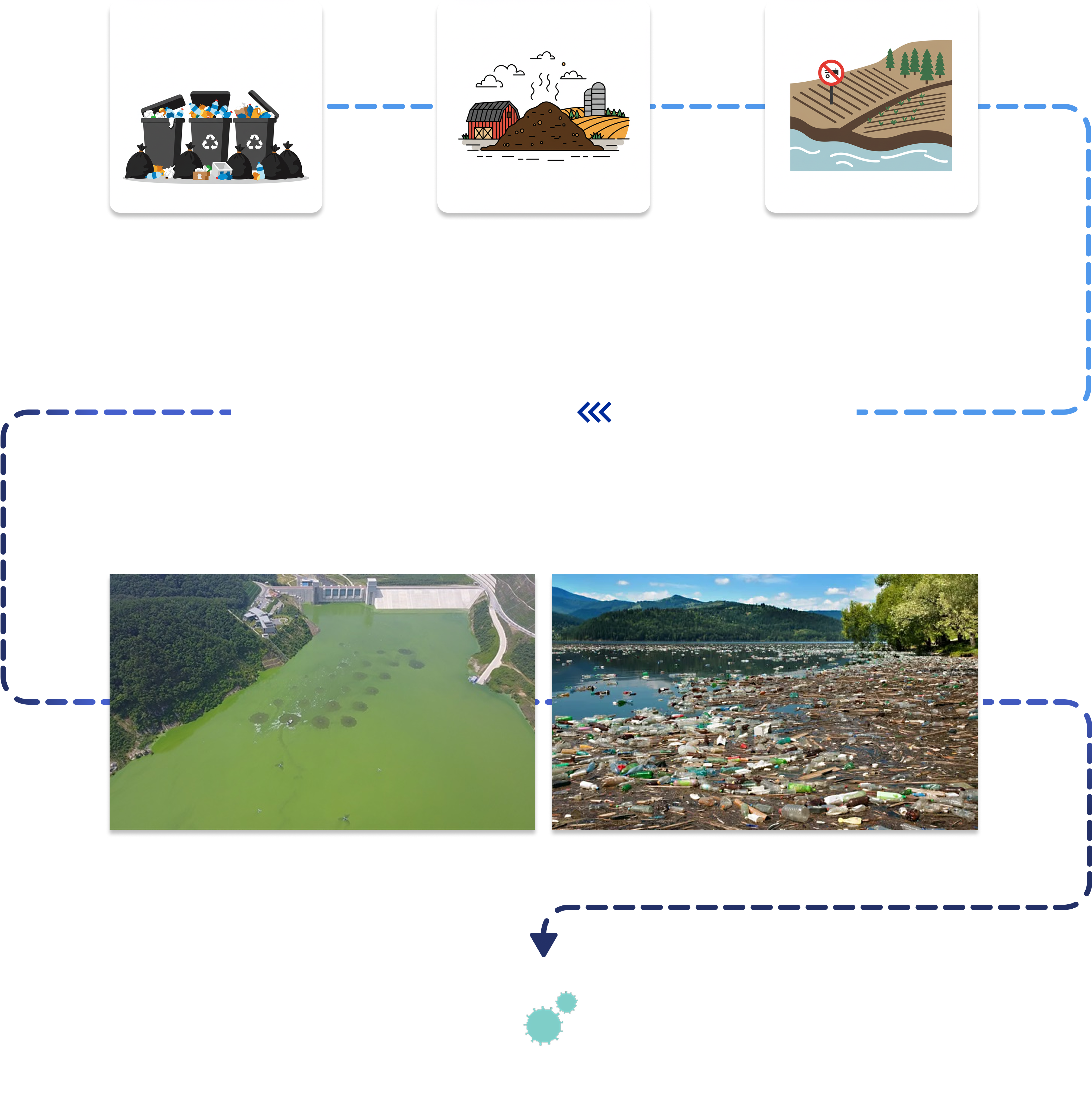
Household waste
Livestock compost
Illegal farmland
Problems with the
existing management method
Relying on site or satellite
It can't process,integrate big data quickly
Green algae phenomenon
Pollution concentrated in upstream areas
Repeated water pollution
This situation is not limited to the entire region,
We are solving environmental pollution problems through intensive
management of polluted areas.
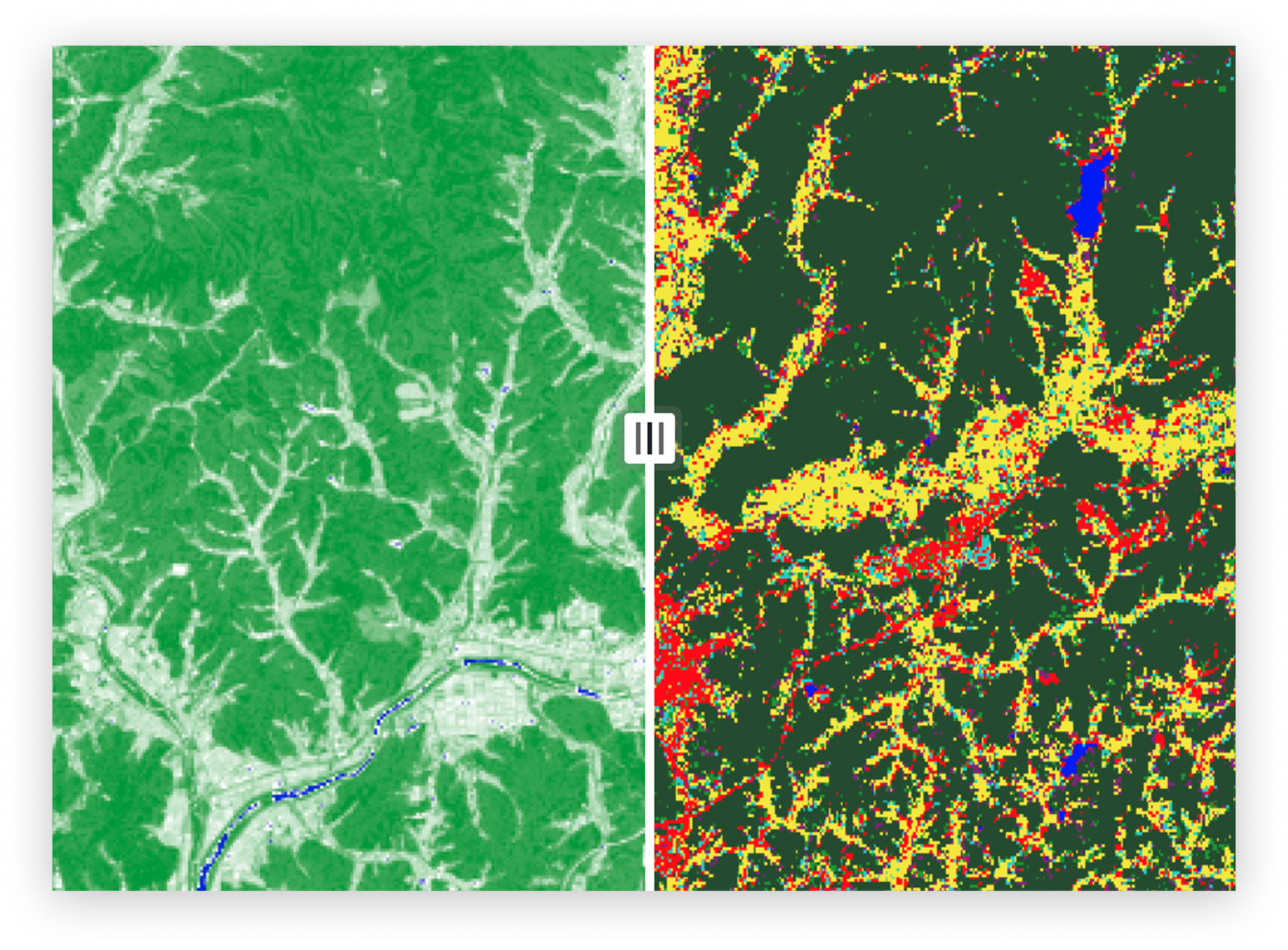
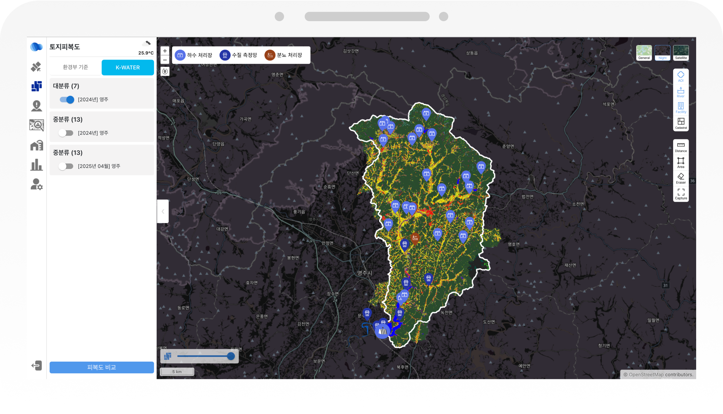
Land cover map
Automatically classify land use
status and predict potential contamination.
K-AQUAS analyzes satellite images using artificial intelligence (AI) and automatically classifies the land in the target area into 13 types, including rice paddies, fields, mountains, and residential areas.
These classification results are used to quantify the amount of pollution generated, and are calculated based on the Ministry of Environment's Total Pollution Load Management Technical Guidelines.
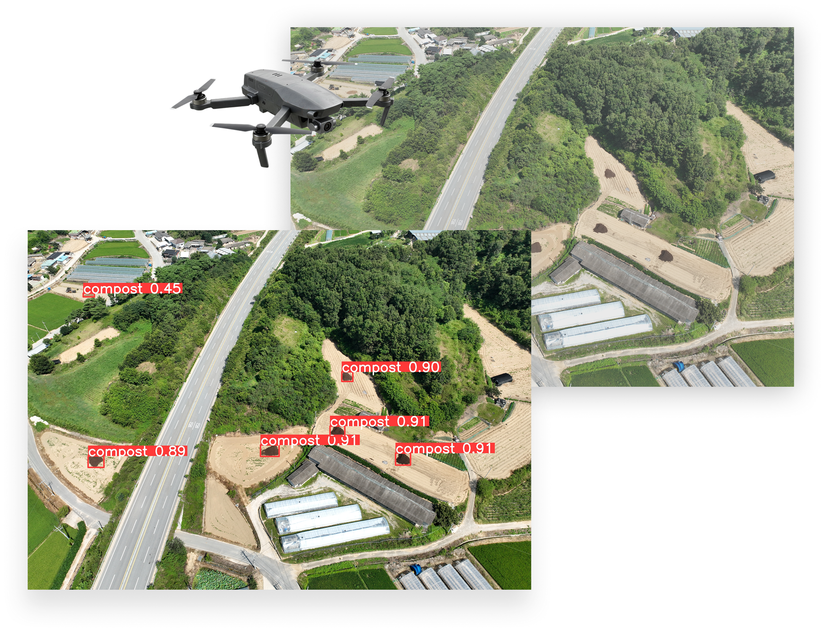
Contamination source object detection
Automatically detects sources of
contamination in drone-captured images.
K-AQUAS automatically recognizes and detects the location of major pollutants, such as compost and livestock waste,
based on high-quality images and videos
collected by drones. Detected pollutants are displayed along
with location coordinates and altitude information,
along with a bounding box.
The detected data is visualized on the administrator screen to support on-site inspection and response
decision making.
Priority management area management
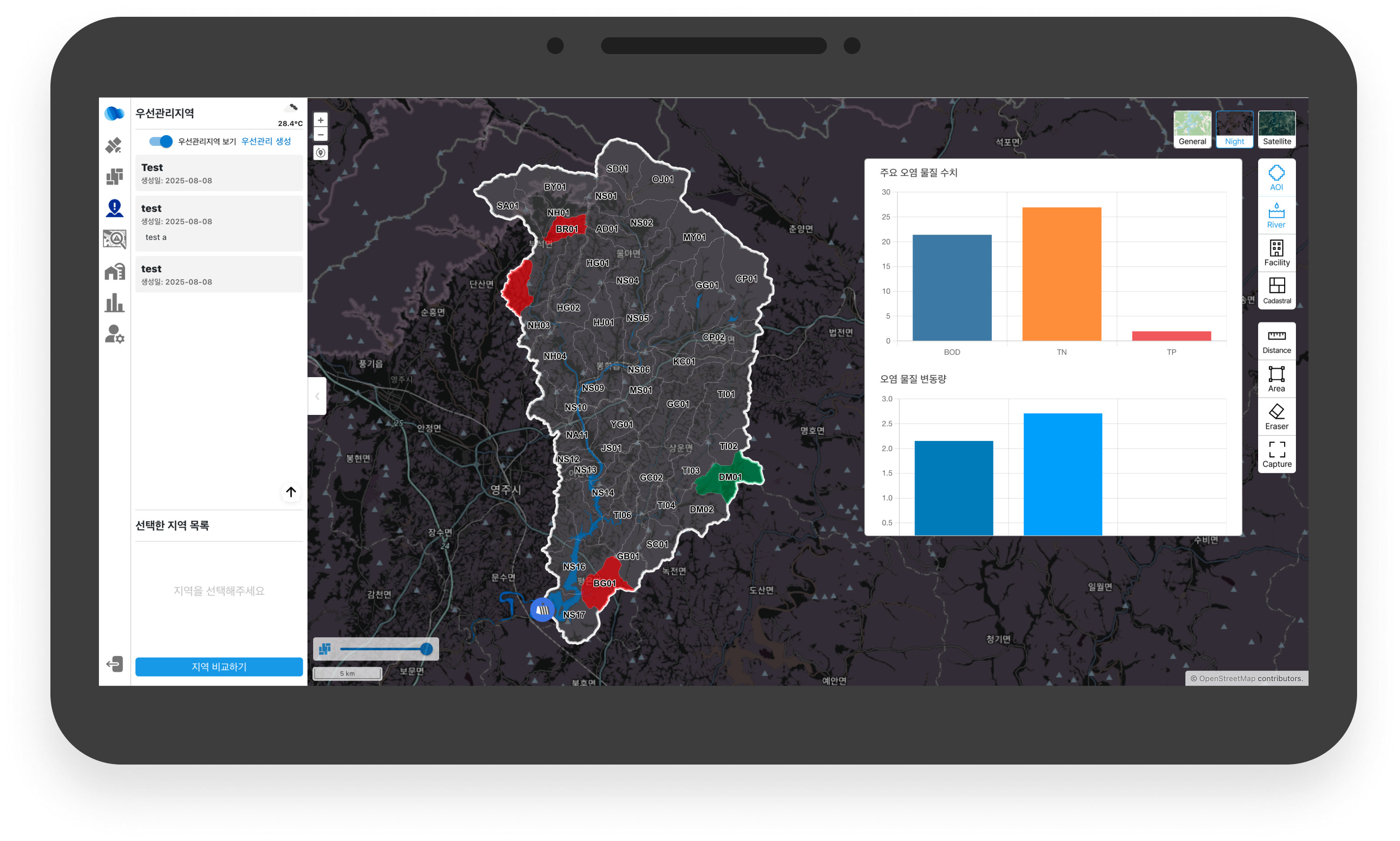
We derive priority management
areas based on data.
Managing all areas by the same standards is inefficient.
K-AQUAS analyzes various environmental data to automatically
select areas in urgent need of pollution control.
The algorithm uses TOPSIS to perform
a comprehensive evaluation by assigning weights
to each major factor, such as precipitation, altitude, and distance from rivers.
Provides various web services
We provide you with data at
a glance and easy to check.
K-AQUAS visualizes complex data
in various forms, including maps, graphs, and tables, so that everyone from field
workers to managers can conveniently utilize it
K-AQUAS provides satellite and drone data and analysis results
as a dashboard and map-based service.
You can check land cover maps, pollution source distribution,
and priority management areas at a glance, and support faster
and more accurate decision-making through data comparison by period and customized management tools
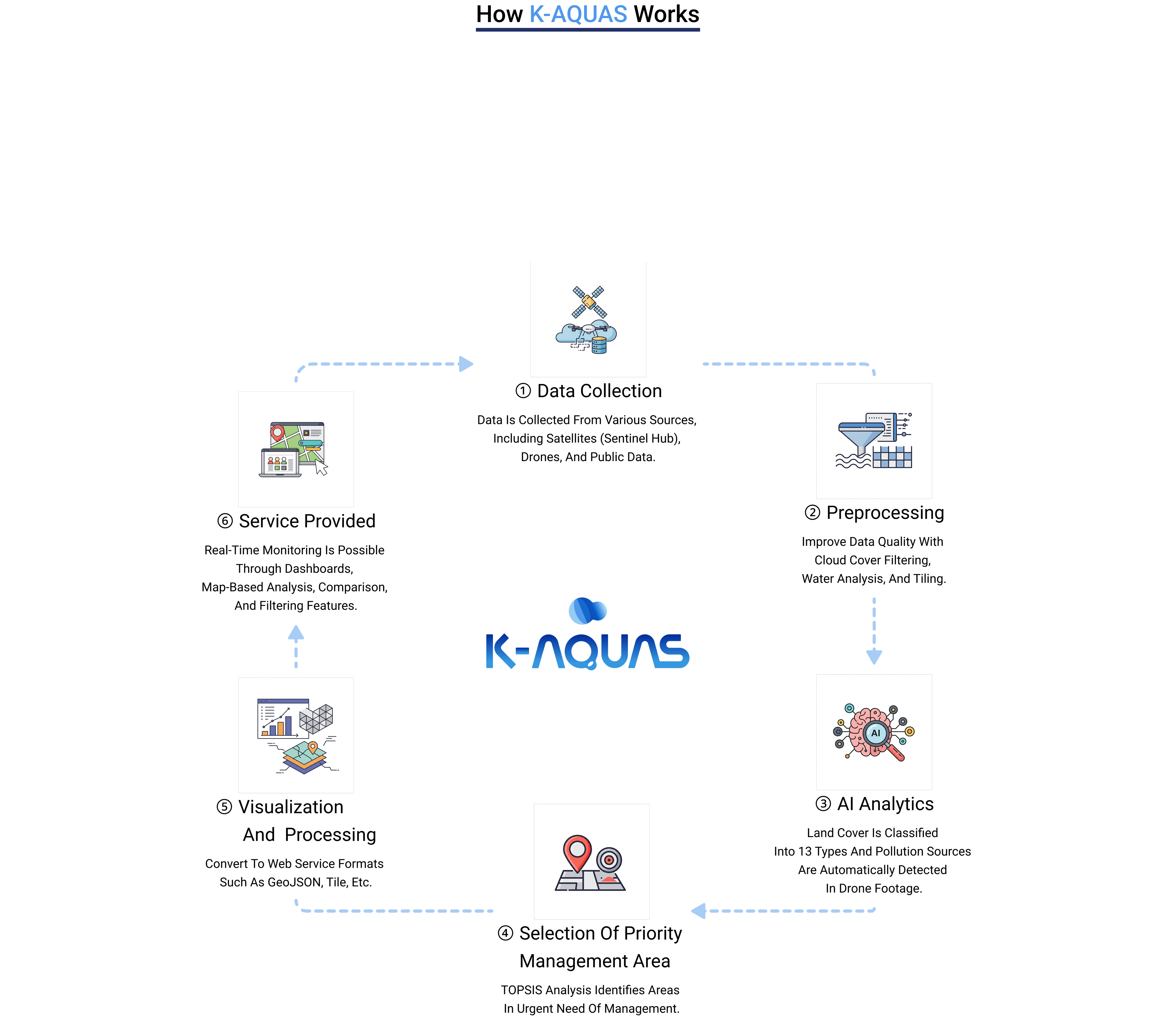
From data collection to analysis, visualization, and management
— K-AQUAS One-Stop Water Quality Management Solution
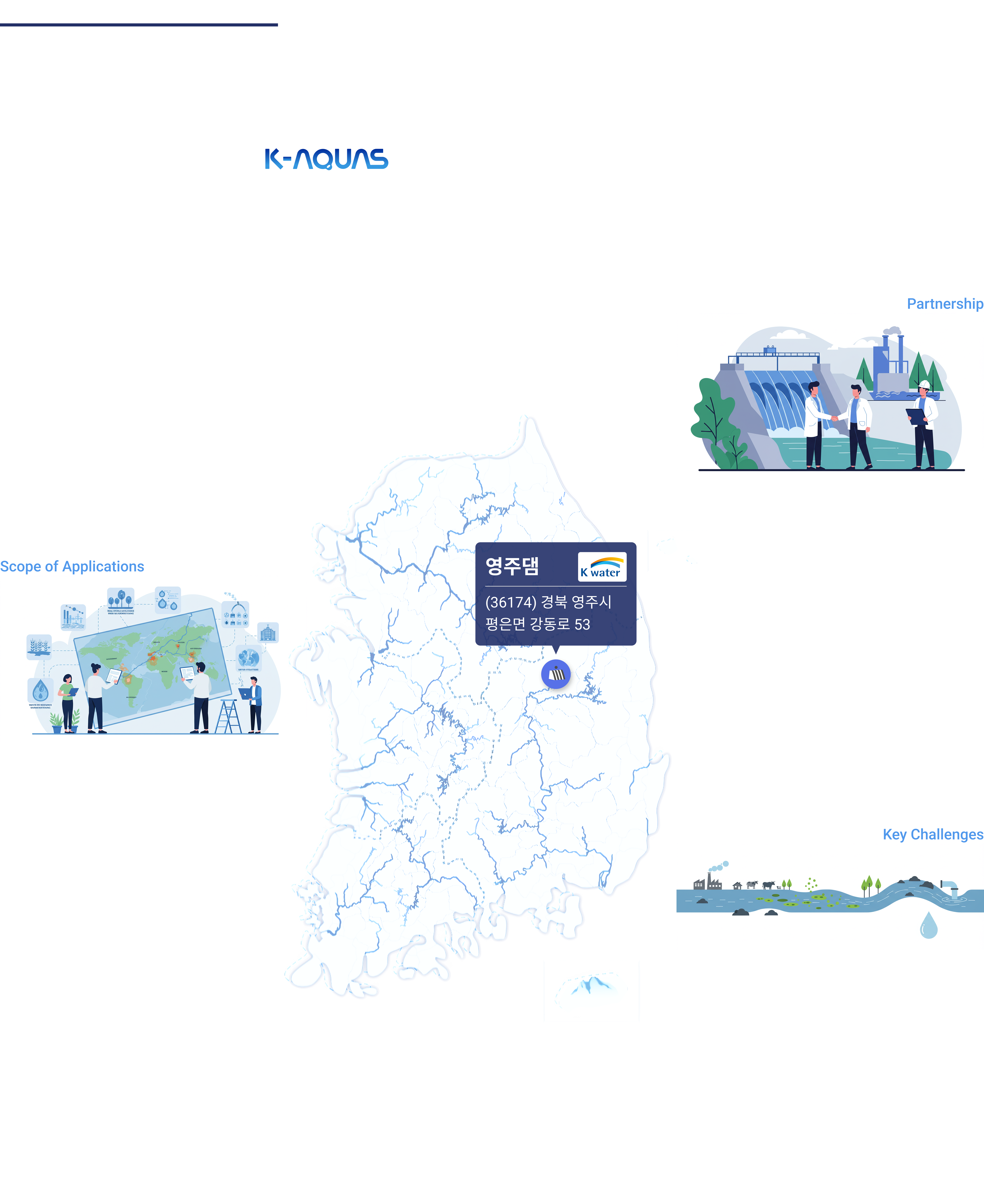
K-AQUAS's main partners are Korea Water Resources
Corporation and Various fields related to
water quality management and environment
an institution or company.
These regions have complex problems, including pollution
from livestock, industry, and living in the
upstream area, green algae and deteriorating
water quality in the midstream area, and
dependence on large-scale water sources
in the downstream area.
Nakdong River Basin 10-Year Comprehensive Plan Section
7 key green algae management areas
Water infrastructure management
Water source protection zones and areas
near water intake sources

Local Applications
2025
Progress in supplementary
work in the Yeongju Dam area
AI model refinement and additional data training,
project completion and testbed verification
Nationwide Expansion
2027
Solving major pollution sources
in domestic watersheds
10-Year Comprehensive Plan for the
Nakdong River BasinSystematically manage seven key
management areas with severe green algae
Global Impact
2030
Progress in supplementary work
in the Yeongju Dam area
Direct participation in local areas such as
the Middle East and Southeast Asia to investigate
water quality issues.
Participation in overseas Expos and business meetings
and MOU signing.
Providing optimal customized services tailored
to each overseas site.
CONTACT

